
![]() Guam Silver Jackets Overview
Guam Silver Jackets Overview
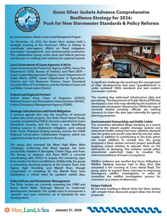
The Guam Silver Jackets, a collaborative group of local and federal agencies working to address natural hazards, recently convened to review ongoing projects and discuss future initiatives.
GCMP worked to form the Guam Silver Jackets and it was established in May 2019. The group consists of federal partners, including the Federal Emergency Management Agency (FEMA), USACE, and the National Oceanic and Atmospheric Association – National Weather Service (NOAA-NWS), and local government agency partners.
By applying their shared knowledge, their goal is to work with communities to enhance an area’s resilience to natural disasters such as flooding. They can provide education, support, and resources in order to do so.
![]() Part of the Guam Silver Jackets’ goals is to incite and effectuate actions to mitigate all hazards on Guam through a comprehensive approach to developing solutions, risk reduction activities, and increasing resiliency.
Part of the Guam Silver Jackets’ goals is to incite and effectuate actions to mitigate all hazards on Guam through a comprehensive approach to developing solutions, risk reduction activities, and increasing resiliency.
Efforts with the United States Army Corps of Engineers (USACE) have rendered comprehensive flood studies to understand riverine flooding over Guam and assessments of the island’s shoreline regarding coastal erosion.
Guam Silver Jackets Advance Comprehensive Resilience Strategy for 2026
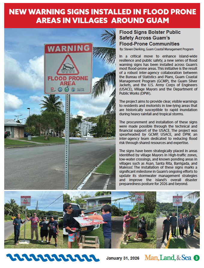
New Warning Signs Installed in Flood Prone Areas in Villages Around Guam
Building a Safer Future: A Featured Article in the August 2024 Man, Land & Sea Publication
Plan Overview
Guam Draft Watershed Assessment
Documents Download
Plan Overview
 Study Area
The study area encompasses the entire island of Guam, the southernmost island in the Mariana Islands archipelago. The northern part of the island is a forested limestone plateau with sheer coastal cliffs. The southern part contains volcanic peaks covered in forest and grassland. Coral reef surrounds most of the island, except in the areas where bays exist that provide access to small rivers and streams. The Northern Guam Lens Aquifer (NGLA) is the main source of drinking water for the island.
Guam experiences two seasons: the dry season beginning in December and lasting through June, and the wet season when three-quarters of the annual rainfall occurs. Guam is periodically exposed to the effects of typhoons three times a year on average. The typhoons come within 180 nautical miles of the island. The current population of Guam is approximately 154,000 persons.
Shared Vision
The Territory of Guam spans 212 square miles of island bordered by 78 miles of coastline in the western Pacific Ocean. Weather related hazards, including tropical cyclones, flooding, high surf, drought, and severe wind are anticipated to intensify with climate change, with a predicted ½- to 1 ½ -foot rise in sea level by 2050. Additionally, anthropogenic stressors, including wildfires, deforestation, introduction of invasive species, erosion, sedimentation, and water quality impacts harm the social, economic, and environmental fabric of life on the island and increase vulnerability to natural hazards. Reducing the consequences of these hazards necessitates a collaborative focus on resiliency among Federal and Territorial agencies and stakeholders. This WA is intended to serve as a strategic roadmap to inform future decisions and actions.
Guam Draft Watershed Assessment
Documents Download
- Guam Public Review Summary
- Guam Watershed Assessment
- Appendix A -02a-Guam Cooperation Letters
- Appendix A -02b-Guam Letters of Support
- Appendix A -02c-Guam Interagency Alignment
- Appendix B – Economics and LifeSIM
- Appendix C – Engineering Analysis
- Appendix D – Environmental Analysis
- Appendix E – Cultural Resources Analysis

James Pangelinan
Planner, GUam Coastal Management Program