
Protecting Our Island’s Green Heart: A Look at the Guam Forest System Plan
Guam’s forests are more than just trees; they are the guardians of our water quality, the home of our unique wildlife, and the backdrop for our island’s rich cultural heritage. In March 2022, the Department of Agriculture and the Bureau of Statistics and Plans released the Guam Forest System Plan, a comprehensive framework designed to implement the Guam Forest Legacy Act of 2012. 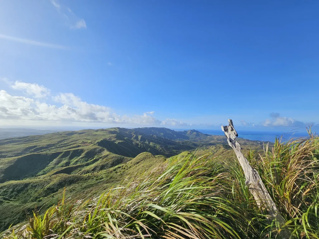
Here is an overview of how this plan aims to protect Guam’s natural resources for future generations.
The Vision: Why a Forest System?
The Guam Legislature enacted the Forest Legacy Act because the protection of natural resources, open spaces, and historical artifacts is critical to the people of Guam. The Forest System Plan was created to operationalize this vision, managing conservation areas to balance public use with long-term environmental protection.
The plan focuses on four primary goals:
• Protecting Water Quality: Managing watersheds to safeguard surface water, groundwater, and nearshore marine habitats by controlling erosion and reforesting ravine forests.
• Enhancing Ecosystems: Protecting rare plants and native habitats while managing spaces for the potential reintroduction of species that have disappeared.
• Supporting Public Access: Creating and maintaining trails and recreation areas to ensure the public can enjoy hiking, hunting, and camping safely.
• Strengthening the Economy: Promoting sustainable forest products and ecotourism while protecting key ecosystem services like flood abatement.
Where is the Forest System?
 The plan includes a detailed inventory of government lands identified for conservation. These range from popular scenic spots to critical wetlands. Some notable locations included in the inventory are:
• Hagåtña: Agana Wetlands, Agana Central Park, and Fort Santa Agueda.
• Dededo: Dededo Sports Complex, Wettengel Park, and the iconic Puntan dos Amantes (Two Lovers Point).
• Southern Guam: Extensive areas in Humåtak and Malesso’ (Merizo), including the Guam Territorial Seashore Park and Bolanos Atate.
• Yigo: Lands such as the Northwest Field and the Pagat Site.
The Department of Agriculture maintains a database of these lands to guide site-specific management plans.
What Can You Do in the Forest System?
The Forest System is designed for public enjoyment, but activities are regulated to prevent damage to the environment.
Allowed Activities (No Permit Required)
• Hiking & Picnicking: Walking on trails and picnicking in open spaces is generally allowed.
• Mountain Biking: Allowed, but riders must stay on designated trails.
Activities Requiring a Permit
Some activities require oversight to ensure safety and conservation:
• Camping: Allowed only in designated areas with a permit (Proposed fee: $30/night).
• Hunting: Regulated by existing laws; requires a license and tags (Proposed fees: $15/license, $10/deer tag.
• Scientific Research: Requires a permit to ensure proper protocols are followed.
• Commercial Use: Ecotours, filming, or other business ventures require permits to ensure they do not harm the ecosystem.
The Threats We Face
The plan is transparent about the severe threats facing Guam’s forests. [cite_start]The islands’ forests are currently threatened by development, poor land-use practices, and fire.
Invasive Species are a major concern:
• Vines: “Chain-of-love” climbs native trees, blocking sunlight and causing them to break during high winds.
• Insects: The cycad scale has devastated the native “fadang” trees, and the coconut rhinoceros beetle kills coconut trees.
• Animals: Feral pigs and Philippine deer eat seedlings and damage mature trees. The brown tree snake has wiped out bird species essential for seed dispersal.
Wildfire is another critical threat. It is often human-caused and accelerates erosion, which damages coral reefs. The plan calls for firebreaks, fuel reduction, and community wildfire protection plans.
Moving Forward: Biosecurity and Restoration
To combat these threats, the plan outlines aggressive strategies, including:
• Biosecurity: Implementing programs to prevent new invasive species from entering management areas.
• Reforestation: Removing invasive trees and grasses to promote native plant growth and distributing native seeds and seedlings.
• Erosion Control: Installing sediment socks and planting vetiver grass or acacia to trap sediment and protect fresh water.
The Guam Forest System Plan is a living document. It includes provisions for leasing land for conservation concessions, allowing groups to manage lands for specific conservation goals, and requires a review of the system every five years. Through this plan, Guam aims to ensure that its forests remain a vibrant resource for the community today and forever.
Next Steps and Timeline:
The development of the GFSP Rules and Regulations is guided by a clear set of SMART objectives to ensure progress remains on track:
• Stakeholder Planning Meetings – Completed on September 9, 2025, successfully convening multiple stakeholders to identify priorities and regulatory needs.
• Draft Rules and Regulations Completion – A comprehensive draft of new or amended rules will be developed by June 30, 2026.
• Economic Impact Statement – To meet the requirements of the Administrative Adjudication Law, the Economic Impact Statement will be finalized by June 30, 2026
• Public Hearing – Required notices and at least one public hearing will be conducted by July 31, 2026 to gather community feedback.
• Submission to Executive Branch – The draft rules and regulations will be submitted to the Office of the Governor and the Office of the Attorney General for review and approval by August 31, 2026.
• Legislative Submission and Passage – The final step will be submission to the Guam Legislature for review and passage by September 30, 2026, ensuring the rules are adopted before the close of the 38th Guam Legislature’s term.
These milestones reflect Guam’s commitment to not only drafting strong regulations but also ensuring that they are transparent, enforceable, and aligned with both environmental protection and community needs. Together, they set the course for transforming the Guam Forest System Plan into a legally enforceable framework that will safeguard Guam’s forests for the future.
Downloads
• Download the Guam Forest System Plan prepared by the Department of Agriculture and the Bureau of Statistics and Plans.
• Download the Guam Forest System Plan Legislation.

Christian Paul Benitez
Planner III, Land and Natural Resource Planning