
LEARN MORE ABOUT COASTAL HAZARDS
Section 309 Enhancement Areas Overview
The National Coastal Zone Management Program (NCZMP), which was established under the Coastal Zone Management Act (CZMA), establishes a voluntary partnership between the federal government and U.S. coastal and Great Lakes states and territories to protect, restore, and responsibly develop coastal communities and resources. Administered by National Oceanic and Atmospheric Administration (NOAA), the NCZMP provides funding and technical assistance to support state efforts in managing coastal areas through planning, conservation, and sustainable development, with the intent of the program being to encourage states and territories to improve their Coastal Zone Management Programs in key enhancement areas of national interest.
The Coastal Zone Enhancement Program (CZEP) which was created through Section 309 of the Coastal Zone Management Act, as amended in 1990 and 1996, established a voluntary coastal zone enhancement grants program, and provides funding and technical support to assist coastal management programs develop and implement strategies that strengthen resource protection and address emerging coastal challenges. The CZEP provides a voluntary 5-year cycle process for a federally approved coastal management program to review, assess and realize opportunities addressing one of, or more, nine enhancement areas that are deemed a high-priority for the coastal management program. The following enhancement areas that are assessed include wetlands, coastal hazards, public access, marine debris, cumulative and secondary impacts, special area management plans, ocean and great lake resources, energy and government facility siting, and aquaculture, all of which have their own respective objectives as follows:
-
-
Wetlands: Protection, restoration, creation, or enhancement of the existing coastal wetlands;
-
Special Area Management Plan: Preparing special area management plans for important coastal areas;
-
Energy and Government Facility Siting: Developing policies to facilitate the siting of government and energy-related facilities and activities;
-
Cumulative and Secondary Impacts: Assessing the cumulative and secondary impacts of coastal growth and development;
-
Coastal Hazards: Prevent or significantly reduce threats to life and property by eliminating development and redevelopment in high-hazard areas, managing development in other hazard areas;
-
Marine Debris: Reducing marine debris entering the nation’s coastal and ocean environment by managing uses and activities that contribute to the entry of such debris;
-
Aquaculture: Adoption of procedures and policies to evaluate and facilitate the siting of public and private aquaculture facilities in the coastal zone;
-
Ocean and Great Lake Resources: Planning for the use of ocean and great lake resources; and
-
Public Access: Providing opportunities for public access to coastal areas of recreational, historical, aesthetic, ecological, or cultural value.
-
Section 309 Assessment & Strategy Report
Guam Ocean Shore Public Access Map
Flooding & Technical Reports (Select Report Below)
Part 1 Flood Frequency Estimates for Streams on Guam
Part 2 Umatac River
Part 3 Manell River
Part 4 Upper Namo River
Hagatna River Flood Hazard Study
Part 1 Flood Frequency Estimates for Streams on Guam
Part 2 Umatac River
Part 3 Manell River
Part 4 Upper Namo River
Hagatna River Flood Hazard Study
LEARN MORE ABOUT COASTAL WATER RESOURCES
 Guam Silver Jackets Overview
The Guam Silver Jackets, a collaborative group of local and federal agencies working to address natural hazards, recently convened to review ongoing projects and discuss future initiatives.
GCMP worked to form the Guam Silver Jackets and it was established in May 2019. The group consists of federal partners, including the Federal Emergency Management Agency (FEMA), USACE, and the National Oceanic and Atmospheric Association – National Weather Service (NOAA-NWS), and local government agency partners.
By applying their shared knowledge, their goal is to work with communities to enhance an area’s resilience to natural disasters such as flooding. They can provide education, support, and resources in order to do so.
 Part of the Guam Silver Jackets’ goals is to incite and effectuate actions to mitigate all hazards on Guam through a comprehensive approach to developing solutions, risk reduction activities, and increasing resiliency.
Efforts with the United States Army Corps of Engineers (USACE) have rendered comprehensive flood studies to understand riverine flooding over Guam and assessments of the island’s shoreline regarding coastal erosion.
Guam Stormwater Drainage Manual
Overview
Volume 1
Volume 2
Guam Stormwater Management Manual Update
Calculation Tool Training Video
Stormwater Design Specifications
References
Overview
Erosion and Sedimentation Control Permits are issued by the Guam Environmental Protection Agency. They are often a condition Clearing and Grading Permit that the Department of Public Works issues. Since Clearing and Grading Permits Require GEPA review for compliance with the Guam Soil and Sedimentation Control Regulations, GEPA actually assumes the lead review and approval responsibility. For most Clearing and/or grading permits there must be an accompanying Erosion Control Plan (ECP) to protect water quality of the closet body of water, fresh or marine. Erosion Control Plans are a requirement of most land grading and clearing permits issued by the Building Official, Department of Public Works. Such a plan must accompany the permit application and must be prepared in compliance with the promulgated Soil Erosion and Sedimentation Control Regulations.
Preparing and implementing an Erosion Control Plan is generally the responsibility of the contractor, who must use accepted erosion control methods to hold soil on-site during the construction period. In some cases, especially during the wet season, special erosion control and sedimentation control measures must be taken to prevent environmental problems. An Erosion Control Plan is usually prepared an integral part of the Environmental Protection Plan (EPP). However, it may be developed as a separate or supporting document. With large projects, like subdivisions or projects on a sloping terrain, the Erosion Control Plan becomes the focal point of the EPP. Review and approval of an Erosion Control Plan by GEPA can take one week or longer, depending on the complexity of the project and completeness of the Plan upon submittal.
The 2006, the CNMI and Guam Stormwater Management Manual (Stormwater Management Manual) was developed to assist the local engineering and development communities and local government agencies in developing and implementing stormwater and erosion control plans that adequately address nonpoint source pollution through the use of currently accepted best management practices (BMPs). Guam formally adopted the Stormwater Management Manual under Executive Order 2012-02 in January, 2012.This manual was generally intended to update and replace previous reference manuals in CNMI and Guam, most notably the Guam Storm Drainage Manual (U.S. Army Corps, 1980), Stormwater Control Handbook (Soil and Water Conservation Districts of CNMI, 1989), and the Erosion and Sediment Control Manual (GEPA, 2000). Unfortunately, the sheer volume of material and diversity of topics of the prior materials make it impossible to completely replace these reference materials. Designers, regulators and the regulated community will still need to rely on prior publications for reference to the following topics:
-General Hydrology
-Drainage Design/Pipe Sizing
-Floodplain Management
-Design Specifications for Erosion and
-Sediment Control Practices
In collaboration with the Bureau of Statistics and Plans, The Guam Environmental Protection Agency, and The Department of Public Works, the USACE developed the Guam Stormwater Manual Update and Storm Drainage Runoff Calculation Tool in 2024. This update and tool are intended to simplify the process of performing multiple calculations. These include pre development and post development calculators for:
-Runoff Curve Number
-Time Of Concentration And Travel Time
-Tr 55 Peak Runoff Calculation (Graphical Method)
-Runoff Volumes Using Manual Rainfall
-Simplified Infiltration Basin Design From GEPA
-Swale Design
-Bio-Remediation Measures
-Sand Filter
Volume 1
Volume 2
Guam Stormwater Management Manual Update
Below is the Guam Stormwater Management Manual Update that should be used in conjunction with the Storm Drainage Calculation Tool that can be downloaded below
Storm Drainage Runoff Calculation Tool
NRCS Web Soil Survey Map
Calculation Tool Training Video
Stormwater Design Specifications
References
Authority:
“Water Pollution Control Act” Title 10, Chapter 47, Guam Code Annotated
“Soil Erosion and Sedimentation Control” Regulations, 1985.
Regulations
Title 22, Chapter 10 (Guam Soil Erosion and Sediment Control Regulations),
Title 22, Chapter 12 (Guam Individual Wastewater Disposal System Regulations)
Chapter 11 (Guam Water and Wastewater Operator Certification Regulations)
Guides and Reference Material
Click here to download the Guam Shoreline Atlas. A tutorial video on how to use the Atlas and a demonstration of all of the document’s functionality can be found below. The document must be viewed in Adobe Acrobat or Acrobat Reader DC (Free) to use the atlas and all of its features.
Plan Overview
Guam Draft Watershed Assessment
Documents Download
Plan Overview
Study Area
The study area encompasses the entire island of Guam, the southernmost island in the Mariana Islands archipelago. The northern part of the island is a forested limestone plateau with sheer coastal cliffs. The southern part contains volcanic peaks covered in forest and grassland. Coral reef surrounds most of the island, except in the areas where bays exist that provide access to small rivers and streams. The Northern Guam Lens Aquifer (NGLA) is the main source of drinking water for the island.
Guam experiences two seasons: the dry season beginning in December and lasting through June, and the wet season when three-quarters of the annual rainfall occurs. Guam is periodically exposed to the effects of typhoons three times a year on average. The typhoons come within 180 nautical miles of the island. The current population of Guam is approximately 154,000 persons.
Shared Vision
The Territory of Guam spans 212 square miles of island bordered by 78 miles of coastline in the western Pacific Ocean. Weather related hazards, including tropical cyclones, flooding, high surf, drought, and severe wind are anticipated to intensify with climate change, with a predicted ½- to 1 ½ -foot rise in sea level by 2050. Additionally, anthropogenic stressors, including wildfires, deforestation, introduction of invasive species, erosion, sedimentation, and water quality impacts harm the social, economic, and environmental fabric of life on the island and increase vulnerability to natural hazards. Reducing the consequences of these hazards necessitates a collaborative focus on resiliency among Federal and Territorial agencies and stakeholders. This WA is intended to serve as a strategic roadmap to inform future decisions and actions.
Guam Draft Watershed Assessment
Documents Download
- Guam Public Review Summary
- Guam Watershed Assessment
- Appendix A -02a-Guam Cooperation Letters
- Appendix A -02b-Guam Letters of Support
- Appendix A -02c-Guam Interagency Alignment
- Appendix B – Economics and LifeSIM
- Appendix C – Engineering Analysis
- Appendix D – Environmental Analysis
- Appendix E – Cultural Resources Analysis
GET TO KNOW US
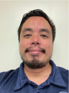
James Pangelinan
Planner, GUam Coastal Management Program
James is a planner with the Bureau of Statistics and Plans – Guam Coastal Management Program (GCMP). His primary
focus is on leading the Coastal Zone Enhancement Program (CZEP), a comprehensive five-year initiative that allows GCMP to
evaluate and improve its strategies across nine national enhancement areas: coastal hazards, wetlands, public access, special area
management planning, energy and government facility siting, aquaculture, marine debris, ocean and Great Lakes resources, and
cumulative and secondary impacts. In addition to his work on CZEP, James actively contributes to the Guam Silver Jackets, a
collaborative inter-agency team comprising local and federal partners. The group works to identify, coordinate, and implement
solutions to reduce coastal hazard risks and build resilience across Guam’s coastal communities.
james.pangelinan@bsp.guam.gov. | 671-475-9666

Contact Us
- P.O. Box 2950 Hagatna, Guam 96932
- (671) 472-4201/2/3
management
- Lola Leon Guerrero - Director - lolalg@bsp.guam.gov
- Matthew Santos - Dep. Director - matthew.santos@bsp.guam.gov
find us
- 513 W Marine Dr. Hagåtña, Guam 96910